
Normals
& Extremes
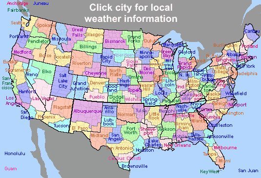
Observations
Outlooks
Documents
Rainfall
& Drought
Severe Weather
Winter
Weather
Organizations
|
|
|
|
|
|
|
|
|
|
CLIMATE DATA SOURCES
Public / Free sites
Some charges may apply
Internal or developmental sites - do not give out URLs (but providing information from these sites is ok)
Resource Files
Station LocationsPulling Hourly or Higher-Resolution Data
Overview of data sources (powerpoint)
Normals & Extremes
* In development; planned first release December 2003
* Free to .edu domain users; others will be charged a fee. See http://www.ncdc.noaa.gov/oa/documentlibrary/pricelists.html for NCDC price lists)
- county summaries - average of county station normals; monthly temperature and precipitation
- County normals - whole state, listed by temperature, precipitation, and degree days
- State temperature maps - annual temperature, days above/below thresholds, seasonal degree days
- State precipitation maps - monthly and nanual normals, annual snowfall
- Monthly Climate Calendar
- CLIMOCS (monthly means and extremes, by station)
- Norman: http://www.srh.noaa.gov/oun/climate/
- Tulsa: http://www.srh.noaa.gov/tulsa/climo.htm
- Amarillo: http://www.srh.noaa.gov/ama/html/climo.htm
- Shreveport: http://www.srh.noaa.gov/shv/climate.htm
Observations (Historical)
* Free to .edu domain users; others will be charged a fee. See http://www.ncdc.noaa.gov/oa/documentlibrary/pricelists.html for NCDC price lists)
- Local Climatological Data
- Climatological Data
- Hourly Precipitation Data
- Storm Data
- Monthly Climatic Data for the World
- COOP Data / Record of Observations (B-91 forms)
- Other Publications
- Climatological Data
- Local Climatological Data
- Storm Data
- Hourly Precipitation Data
- NCDC Normals
- Daily Weather Maps
- Norman: Oklahoma City, Wichita Falls (TX), Bethany, Clinton, Frederick, Gage, Guthrie, Hobart, Lawton, Ponca City, Stillwater
- Tulsa: Tulsa, Bartlesville, Muskogee, Fayetteville (AR), Highfill (AR), Fort Smith (AR), McAlester, Tulsa Riverside (Jenks)
- Amarillo: Amarillo, Borger, Dalhart, Guymon
- Shreveport: De Queen (AR), El Dorado (AR), Longview (TX), Lufkin (TX), Monroe (LA), Shreveport (LA), Texarkana (AR), Tyler (TX)
Oklahoma Mesonet
- Timeseries - actual observations from any selected time period, station
- Timeseries - monthly: summarized observations for selected period, station
- A month in time - calendar of observations (single station)
- Statewide Records - 'Top-20' list for all stations, all years on a given date
Surface Airways Observations
Upper Air / Soundings
Outlooks
Documents
- ES-2002-01: January 28-30, 2002: Oklahoma Ice Storm
- ES-2002-02: The Oklahoma Drought of 2001-2002
- ES-2003-01: Oklahoma Ice Storm: December 3, 2002
- ES-2003-02: May 8-9, 2003 Tornadoes
- Tornadoes (Gary McManus)
- Thunderstorms / High Winds / Hail / Lightning (Gary McManus)
- Floods (Derek Arndt)
- Winter Storms (Gary McManus)
- Drought (Derek Arndt)
- Wildfires (Mark Shafer)
- Extreme Temperatures / Heat Index / Wind Chill (Mark Shafer)
- Dam Failures (Mark Shafer)
- OCS Overview (Mark Shafer)
Mesonet Site Map (STIDs)Federal Observing Sites, Southern Region
National Climate Divisions (from CDC)
Oklahoma Ecoregions (Tourism)
Rainfall & Drought
Severe Weather
- tornadoes - annual number, number by county, time of day
- hail - number of hail days, number of events
* Free to .edu domain users; others will be charged a fee. See http://www.ncdc.noaa.gov/oa/documentlibrary/pricelists.html for NCDC price lists)
Preliminary Storm Reports:
- Shreveport WSFO (Not Available)
- Text products issued by area offices or Storm Prediction Center
- Climate data and weather roundup (KOUN only)
- Temperature and precipitation tables
- Area Weather Summaries
- Zone and short-term forecasts and discussions
- Local storm reports
- Watches and warnings
- Special weather statements
- Public information statements
- Mesoscale discussions and outlooks
- 15 local-area radars + 3 mosaic products; 1998-present
- offline orders only
- Average date of first / last frost, freeze, or hard freeze
- Average frost-free period
- Earliest / latest freeze
- First / last freeze distributions (10%, 30%, 50%, 70%, 90%)
Organizations
Oklahoma Climatological Survey (OCS)Public pages (real-time)Premium pages (real-time)
Oklahoma Wind Power Initiative (OWPI)
Oklahoma Water Resources Board (OWRB)
National Climatic Data Center (NCDC)
American Association of State Climatologists (AASC)
Southern Regional Climate Center (SRCC)
National Drought Mitigation Center (NDMC)
National Oceanographic and Atmospheric Administration (NOAA)
Regional Integrated Sciences and Assessments (RISA)
National Weather Service (NWS)
Climate Services DivisionClimate Prediction Center (CPC)
Storm Prediction Center (SPC)
National Severe Storms Laboratory (NSSL)
River Forecast Center, Tulsa (ABRFC)